St. Manvieu War Cemetery, Cheux
- Country France
- Total identified casualties 2047 Find these casualties
- Region Calvados
- Identified casualties from Second World War
- GPS Coordinates Latitude: 49.17741, Longitude: -0.5139

SHARE THE STORIES OF D-DAY AND NORMANDY
If you'd like to know more about who we commemorate, visit For Evermore: Stories of the Fallen, the CWGC online commemorative resource. Here you can read and share the fascinating stories from some of the people who took part in D-Day and Normandy Campaign.
Location information
Cheux is a village 10 kilometres west of Caen.
This cemetery is reached from Caen by taking route D9 westwards. After about 8 kilometres, the road by-passes St Manvieu village, while Cheux lies 2 kilometres to the left. You will find St Manvieu War Cemetery on the right hand side.
Visiting information
ARRIVAL
The route to the cemetery is signposted.
PARKING
There is parking along the front of the cemetery at the side of the road in a layby area.
The ground surface is a mixture of tarmac and grass. The ground is firm and flat.
There is a row of low octagonal bollards, approximately 50 mm tall at the boundary of the layby and grass pathway leading to the entrance of the cemetery.
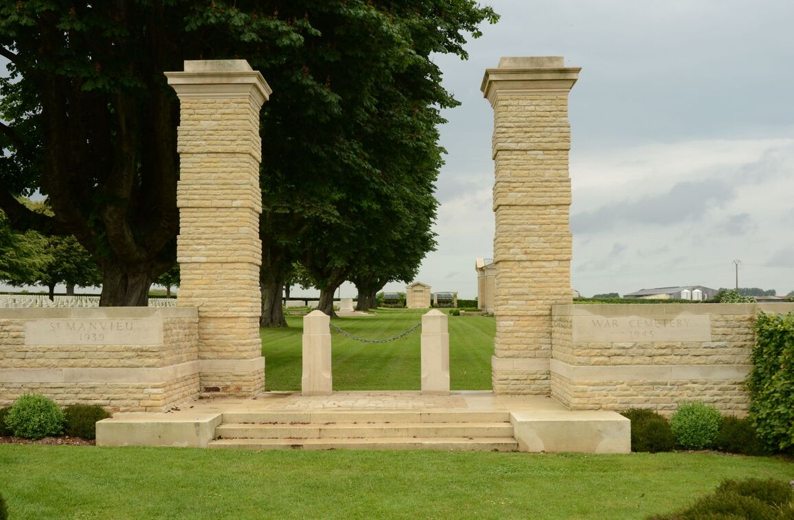
ACCESS LAYOUT AND MAIN ENTRANCE
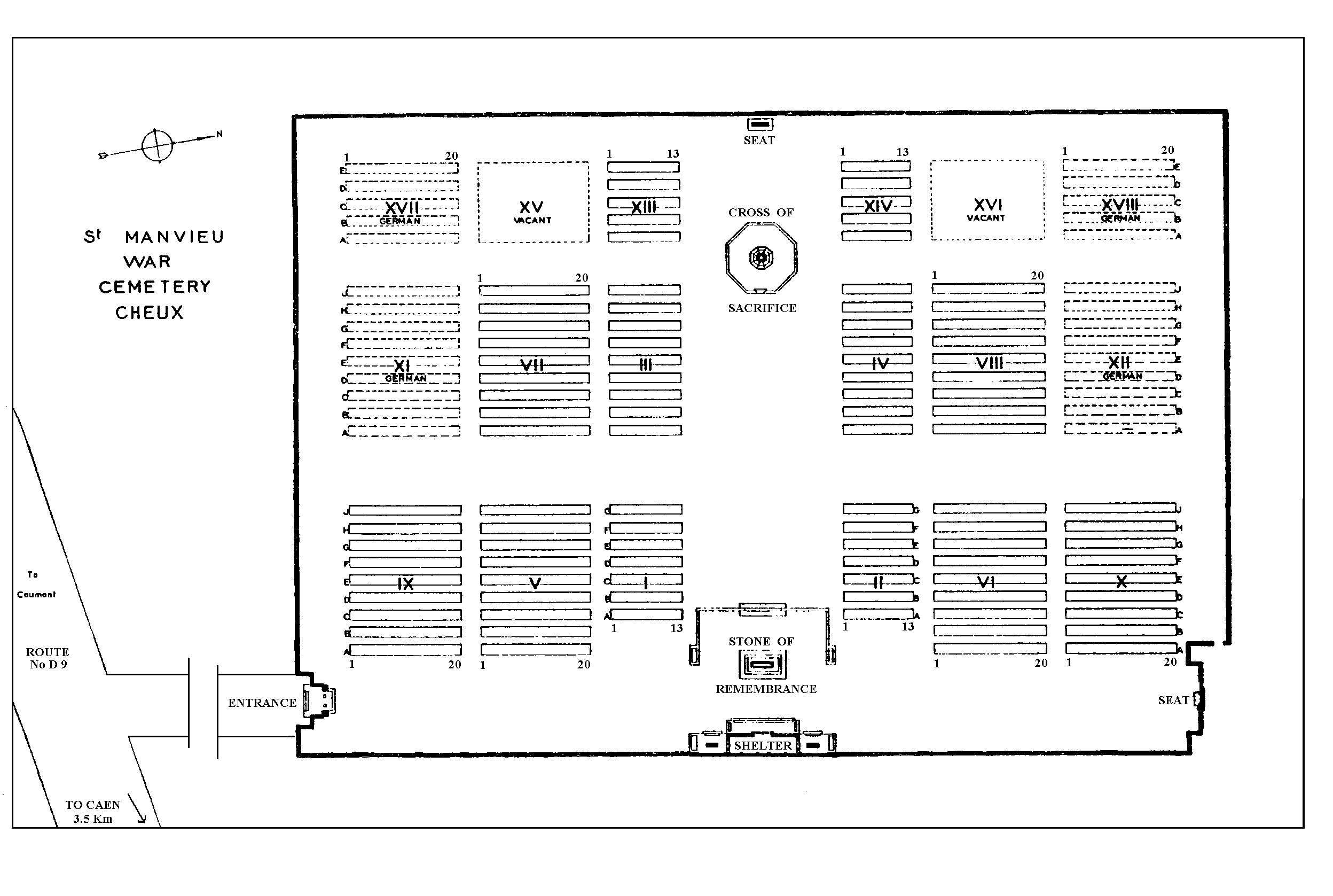
The cemetery is large and rectangular shaped.
From the layby parking at the front of the cemetery is a grass pathway 45 metres long leading to the main entrance.
The main entrance has 3 stone steps leading up to a raised platform. There are 2 stone bollards, approximately one metre apart with a chain between them. The chain can be unhooked from the left bollard. The cobble and stone platform opens directly onto a flat and firm grass surface.
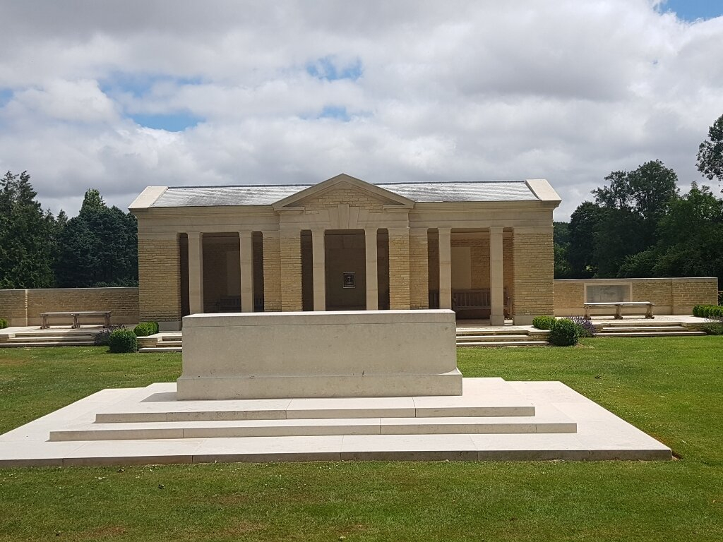
There is a large shelter building located on the eastern end of the cemetery, in line with the entrance. Three steps lead up to the raised platform, in front of the shelter and on either side. There are timber benches on either side of the shelter, as well as inside the building. The platform and inside of the shelter building floor is a combination of cobbles and flat paving.
The Register Box is located inside the shelter building on the rear wall above a stone bench.
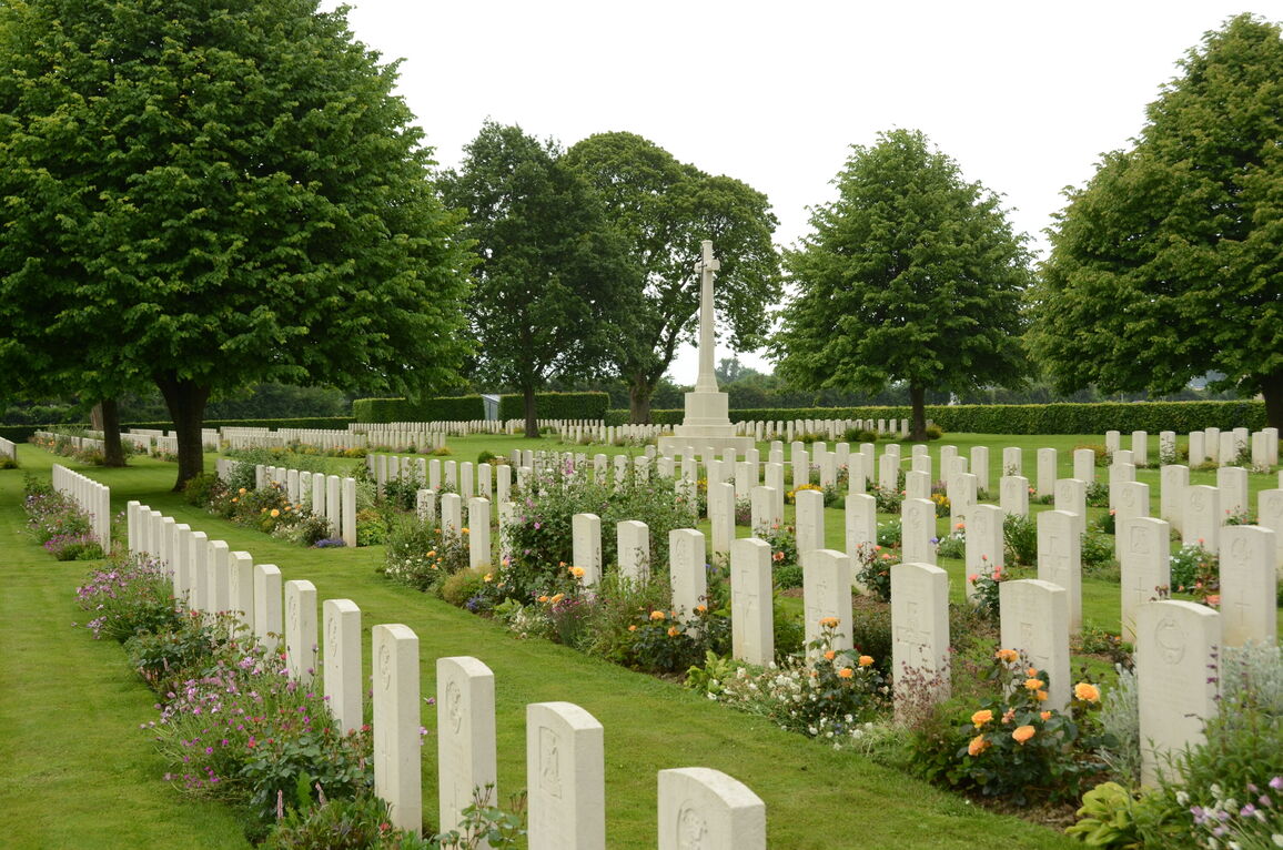
The ground slopes upwards from the shelter building towards the rear of the site, from east to west. The Stone of Remembrance is located in front of the shelter building, in line with the Cross of Sacrifice. A low stone wall runs behind the Stone of Remembrance, between two stone planters. Three steps lead up to the burial area. The low wall is approximately 400 mm tall along its length between the planters. The ground behind the wall and steps is level with the top of the wall. It is possible to bypass the steps by going around either end of the planters. The Cross of Sacrifice is located on a raised stone platform at the western end of the cemetery. Two steps lead up to the Cross of Sacrifice when approaching from the shelter building. The stone wall surrounding the Cross varies in height from 400 mm to 50 mm above the surrounding grass.
There is an additional seating area to the northeast corner of the cemetery, with planted trellises on either side. There is a narrow dirt strip, approximately 100 mm bwde between the grass and a slightly raised paved area in front of the stone seating area.
All internal paths are grassed the ground is firm.
ALTERNATIVE ACCESS
On the left side of the main entrance is a grass track running alongside hedge boundary.
Approximately 10 metres along the track is a 1.20-metre-wide gap in the hedge. This allows free access into the cemetery.
ADDITIONAL INFORMATION
The cemetery is permanently open.
History information
The Allied offensive in north-western Europe began with the Normandy landings of 6 June 1944.
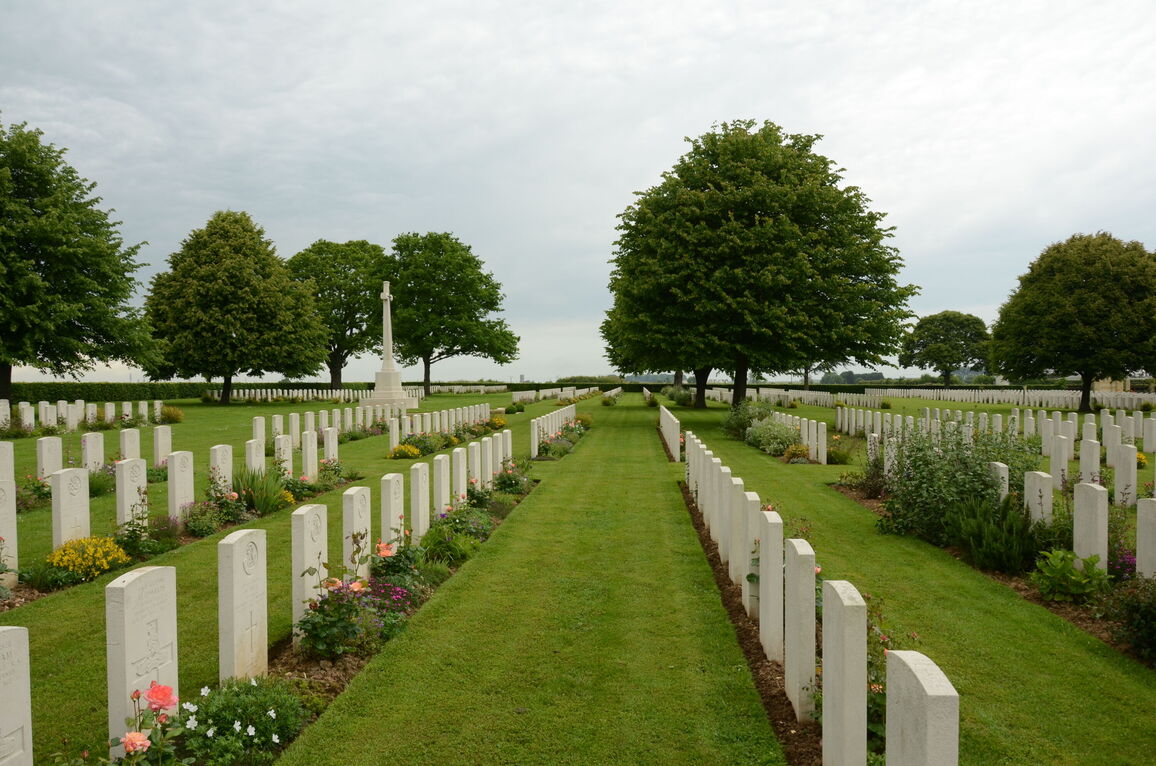
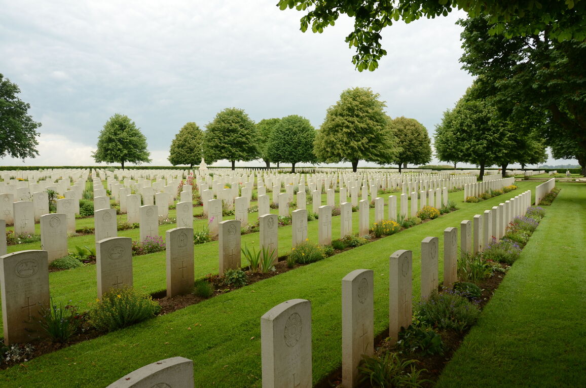
Those buried in St. Manvieu War Cemetery died for the most part in the fluctuating battles from mid June to the end of July 1944, in the region between Tilly-sur-Seulles and Caen.
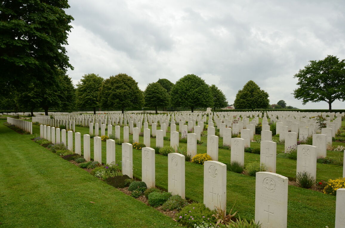
The cemetery contains 1,627 Commonwealth burials of the Second World War, 49 of them unidentified. There are also 555 German burials.
The cemetery was designed by Philip Hepworth.